


Select a language
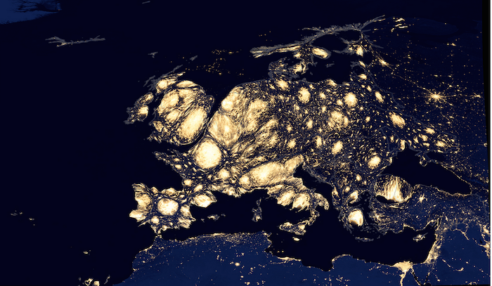
Europe is one of the regions with the highest light pollution in the world because of its demographic density and its high level of development. Using images of the earth at night produced by NASA, the geographer Benjamin D. Henning has published this map of Europe on his site.
The scale of different European regions have been modified according to their population, such that the most densely populated regions appear bigger, with each section of the map representing a similar number of inhabitants. As you might expect, the most densely populated zones - like London, the Benelux nations or the Ile-de-France region - are also the most brightly lit.
The map shows two interesting differences present in Europe. First, western Europe is on the whole clearly more illuminated than eastern Europe. Second, there are regions in Europe where the population is concentrated in a few large cities (in eastern Europe, but also in Paris, Madrid and Athens) and then there are regions characterised by a dense network of medium-sized cities, like in northern Italy, western Germany and the Benelux nations.
Do you like our work?
Help multilingual European journalism to thrive, without ads or paywalls. Your one-off or regular support will keep our newsroom independent. Thank you!