


Select a language
By Lorenzo Ferrari.
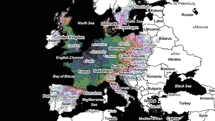
Leaving from Brussels, how long does it take to reach another point in Europe? Using data provided by the Swiss Transport API, Peter Kerpedjiev has published on his blog a map showing the journey times by train to Europe's major cities. For the regions not reachable by train, it shows a time estimation of the journey on foot.
The distances illustrated by the map are not just physical, but also to some extent cultural. On the one hand, this map shows how the institutional heart of Europe is closely linked with France, Germany and southern England. On the other, it also demonstrates the wide gap separating Brussels from regions in the south and east of the EU.
Was this article useful? If so we are delighted!
It is freely available because we believe that the right to free and independent information is essential for democracy. But this right is not guaranteed forever, and independence comes at a cost. We need your support in order to continue publishing independent, multilingual news for all Europeans.
Discover our subscription offers and their exclusive benefits and become a member of our community now!